✓ Source: REIN MLS #10658252 · record updated Oct 25, 2026 · synced every 2 min · your inquiry is never resold
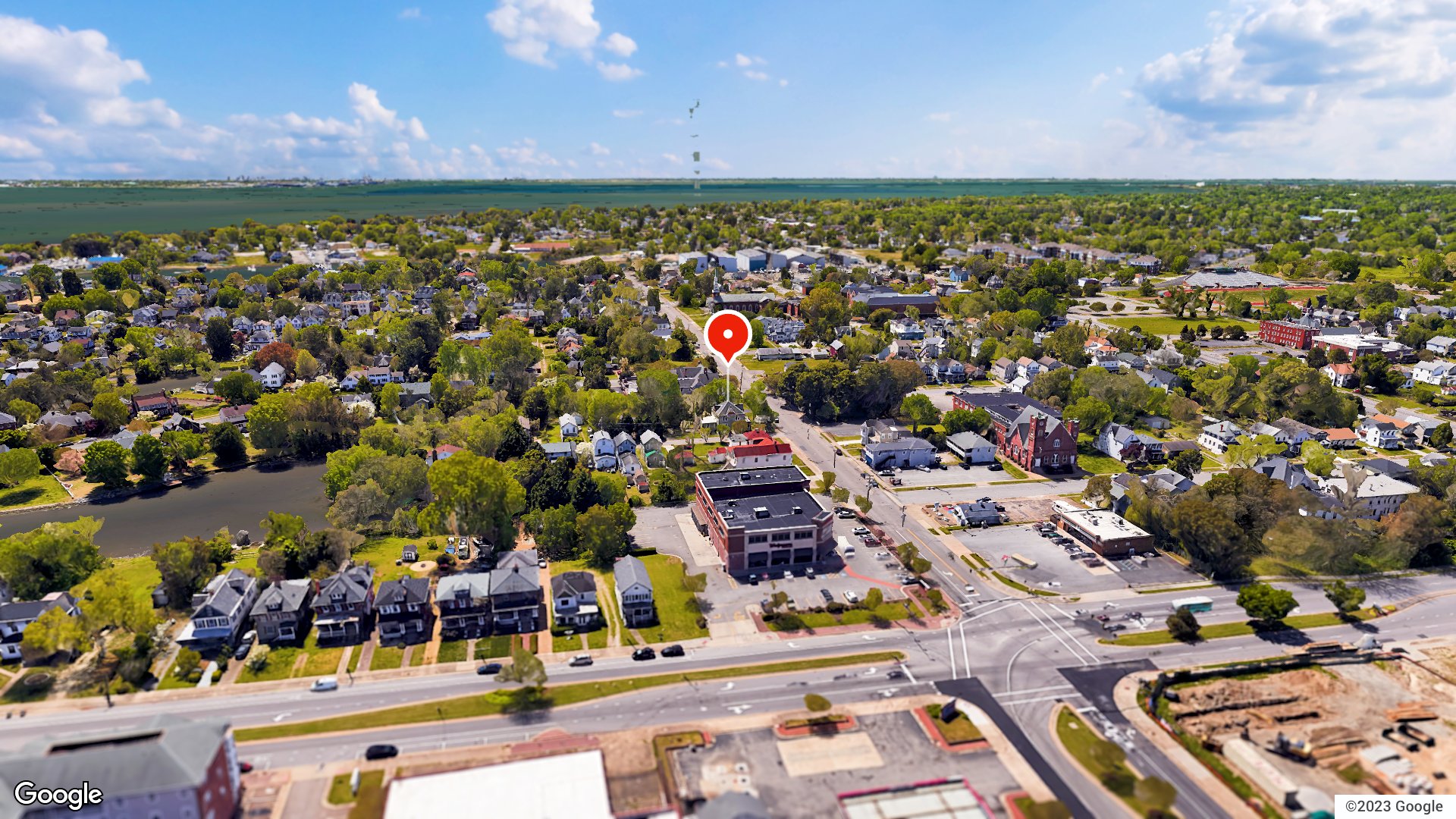
From the air · 1 / 19
2,429sqft
$165per sqft
8days on market

229 S Armistead Ave, Hampton, VA 23669

ActiveMulti Family Residential · built 1883 · ALL OTHERS AREA 102 · MLS #10658252

OverviewAbout this home

Discover a rare investment gem! This historic Victorian home has been converted into a triplex, offering a unique opportunity for primary occupancy or rental income. The lower units are currently rented, while the completely remodeled 2 bed, 1 bath upper unit will be vacant November. Situated on a spacious corner lot with potential for subdivision, less than half a mile from Hampton Yacht Club and local dining spots. Ideal for investors seeking character, rental income, and future development possibilities.

Listing courtesy of Jessica Haynes · REIN MLS #10658252

Facts & features

TypeMulti Family Residential
Year built1883
Price / sqft$165
HOANone
Taxes$3,509/yr
CountyHampton VA
MLS #10658252

Interior

Approx. sqft
2,429

Construction & exterior

Style
Converted S.F.
Subtype
Triplex
Foundation
Basement
Roof
Metal,Slate
Exterior
Vinyl

Utilities & systems

Water heater
Gas
Water
City/County
Sewer
City/County

Lot, parking & ownership

Lot size
132 X 80
Lot features
Corner
Subdivision
ALL OTHERS AREA 102
Zoning
R8
Ownership
Fee Simple
Possession
CLOSING
Miscellaneous
Rehabilitated
Disclosures
Disclosure Statement

Sources: REIN MLS record

Tom & Dariya's overview

Our read on this home

by Tom & Dariya Milan, REALTORS® · Brokered by LPT Realty

At a glance

229 S Armistead Ave is a 2,429-square-foot multi-family property built in 1883 in Hampton, Virginia. The structure carries more than 140 years of history and sits minutes from Joint Base Langley-Eustis. It lands in the heart of the 23669 zip code, close to the waterfront and downtown Hampton.

Read the full overview ↓

Why this home stands out

Buildings from 1883 are rare anywhere in Hampton Roads, and this one still stands at 2,429 square feet. The multi-family layout gives you options that a single-family home simply does not. You are eight minutes from Joint Base Langley-Eustis and ten minutes from NSA Hampton Roads. The Virginia Air and Space Center is less than half a mile away. That combination of age, size, and location is hard to match among Hampton homes for sale.

ALL OTHERS AREA 102 and the Hampton real estate market

South Armistead Avenue sits in the Phoebus neighborhood on the eastern edge of Hampton. Phoebus has its own distinct identity — it was an independent town before merging with Hampton in 1952. The streets here mix late-19th and early-20th century architecture with newer infill, giving the blocks a layered, lived-in character. Sidewalks line most of the neighborhood, and the scale stays human. Fort Monroe National Monument is just across the water, adding open green space and a strong sense of place. Hampton itself is one of the oldest English-speaking settlements in the country. The city wraps around the water on three sides, and getting around is straightforward. Interstate 64 connects you north toward Norfolk or west toward Newport News in minutes. The Hampton Roads Bridge-Tunnel puts Virginia Beach within reach. Anyone comparing homes for sale in 23669 will find this corner of Hampton particularly well-positioned for both history and daily convenience.

What's nearby

Fisher's Landing is two-tenths of a mile away — an easy walk for dinner. Mabuhay Filipino and Soul Kitchen is just 0.3 miles out, offering a distinct dining option close to home. Trimble Field and Eason Park are both under half a mile, giving you green space without a drive. The Dr. Katherine G. Johnson Bench at 0.4 miles adds a meaningful local landmark to the mix. Cosmic Cafe at the Virginia Air and Space Center is 0.4 miles away for a coffee stop with a view. EZ Smoke House and Best of British cover everyday grocery needs within a short walk. Shape Up Fitness is one mile out for a workout.

For different buyers

Base commute and VA loan notes

Joint Base Langley-Eustis is about eight minutes away by car. NSA Hampton Roads is roughly ten minutes in the other direction. VA loan financing is commonly used for properties in this zip code, and the multi-family structure can offer flexibility that a standard single-family purchase does not. The short commute window to two installations is a practical advantage worth noting.

For buyers drawn to character

Buildings this old are genuinely uncommon. Constructed in 1883, 229 S Armistead Ave predates most of Hampton Roads' residential stock by decades. The Phoebus neighborhood adds to the appeal — its pre-annexation history and 19th-century streetscape make it one of the more architecturally interesting pockets in the region. Buyers who want homes for sale zoned for Phoebus High School and homes for sale zoned for Hunter B. Andrews PK-8 will find this address sits squarely in that attendance zone.

More buyer questions

How far is 229 S Armistead Ave from Joint Base Langley-Eustis?

The drive to Joint Base Langley-Eustis is about eight minutes under normal traffic conditions. NSA Hampton Roads is approximately ten minutes in the opposite direction.

What is the flood zone status for 229 S Armistead Ave?

Flood zone information for this address is covered in the FloodRisk tile on this page. Hampton's coastal location means flood zone designation is worth reviewing carefully before any purchase decision.

Is there an HOA at 229 S Armistead Ave?

No HOA is associated with this property. That means no monthly association fees or deed restrictions tied to a homeowners association.

What year was 229 S Armistead Ave built?

The structure was built in 1883, making it one of the older standing buildings in Hampton. It has over 140 years of history on this block.

Where is the nearest park to 229 S Armistead Ave?

Trimble Field is 0.3 miles away, and Eason Park is 0.4 miles out. Both are reachable on foot from S Armistead Ave.

Want to see 229 S Armistead Ave in person? Tom and Dariya Milan can walk you through the property and answer your questions. Reach out to schedule a visit.

Summary generated by AI from public records and publicly available information.

Schools · VaHome School ScoreAssigned schools

Our own 1–10 rating, scored from Virginia Department of Education data.

HighPhoebus High School
6.5/10
Down 0.1 from 2024–25
MiddleHunter B. Andrews PK-8
6.6/10
Up 1.9 from 2024–25
ElementaryHunter B. Andrews PK-8
6.6/10
Up 1.9 from 2024–25

VaHome School Score — calculated by VaHome.com from Virginia Department of Education assessment, progress, and attendance data. Attendance zones come from the MLS listing record; confirm the current zone with the school division before making an offer.

How Far Is?

Driving distance by road and typical drive time via Google Maps, to the nearest location of each.

Also nearby

Distances are straight-line (as the crow flies) from this property, not driving miles. Places within ~1 mile, nearest first. Powered by Google Places.

Homes like this one sell fast — see the next one first

Hampton$335K – $460K

By subscribing you agree to receive listing emails from Tom & Dariya Milan, Realtors, at most one a day. Unsubscribe anytime · Privacy PolicyBrokered by LPT Realty

Military Commute

Drive times to nearest bases

JBLE Langley

Air Force

16min·7.5mi

NSA HR

Navy

25min·15.3mi

MARFORCOM

Marines

22min·14.1mi

NS Norfolk

Navy

19min·13.6mi

NMCP

Navy

36min·24.5mi

Typical drive times from Google Maps, without live traffic. Rush hour and tunnel backups can add time.

Flood & environmentFlood risk (FEMA)

FEMA flood zone X · outside the high-risk area · FIRM 515527

Flood Risk (FEMA)

Source: FEMA National Flood Hazard Layer · FIRM 515527

Low / Moderate Risk

FEMA flood zone

X (low to moderate risk)

Base flood elevation

Not applicable in low-risk zones

Zone X is outside the Special Flood Hazard Area; FEMA doesn’t define a BFE here.

Property elevation

9.1 ft above sea level

USGS 3DEP digital elevation model

Outside the high-risk Special Flood Hazard Area. Federal flood insurance is NOT required, though optional preferred-rate NFIP coverage is still worth considering in coastal Hampton Roads.

Data sources: Flood zone and base flood elevation come from FEMA’s National Flood Hazard Layer. Property elevation is sampled from a single point on the parcel using the USGS National Map elevation service — actual elevations across a single property can vary by several feet higher or lower than the figure shown. Use these numbers as a starting reference and do your own due diligence (a professional survey or elevation certificate) before relying on them for any financial, insurance, or construction decision.

Hurricane Evacuation Zone

Evacuation Zone A

Source: Virginia Dept. of Emergency Management — Know Your Zone

Explore this neighborhoodHampton Roads

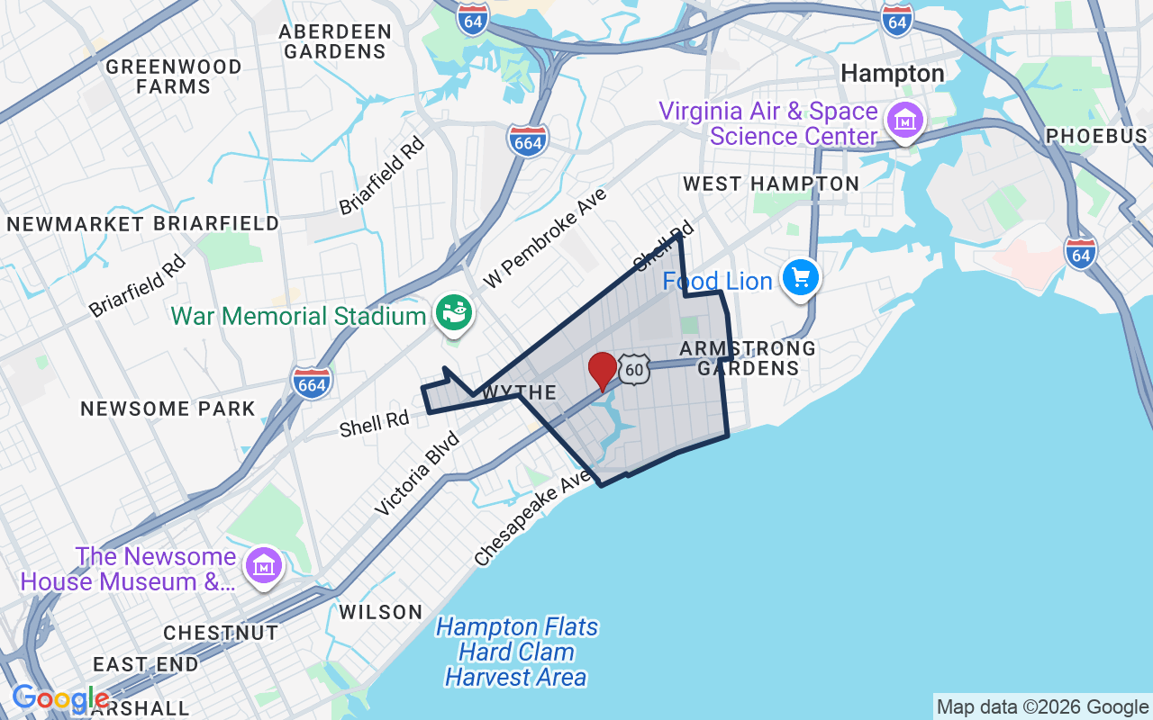
Hampton Roads is a REIN MLS subdivision in Hampton, Virginia — a waterfront neighborhood that shares its name with the wider region. It sits close to the water and has deep ties to the sea.

$257KMedian sale · 12 mo
$172Sold $/sq ft
12dDays on market
4For sale now
$68KHH income
56.2%Owner-occupied

REIN MLS closed sales, trailing 12 mo · U.S. Census ACS 2024 5-year

Explore Hampton Roads →
Map of Hampton Roads with neighborhood boundaryNeighborhood

Hampton VA homes for sale →

CostPayment calculator

Estimates only. Taxes come from the public record; confirm rates with your lender. VA-eligible buyers: $0-down financing may apply.

Estimate your monthly payment

$2,484/mo

Principal & interest

$2,075

Property tax

$292

Home insurance

$117

PMI

None

HOA/Condo (paid separately)

None

Estimate only. Association (HOA/condo) fees are paid separately and are not included in the payment above. Insurance assumed at 0.35% of home value annually. Actual taxes, insurance, and rate will vary by lender, credit, and property. Contact a lender for a personalized quote.

Value & historyComparables

Price context: similar nearby homes$350,000 – $537,000The 6 most similar homes nearby (same city, within ~20% of this size, ~2.5 mi; 6 sold). Context for judging the asking price, not an appraisal or an estimate of this home's value.
4017 Monitor DR · 0.9 mi · 2,488 sqft$425,000 sold 2026-07
4021 Chesapeake AVE · 1.1 mi · 2,488 sqft$402,500 sold 2026-07
4012 Buchanan DR · 1 mi · 2,672 sqft$350,000 sold 2026-02

Own a home nearby? See what it is worth today: What's your Hampton home worth?

Sale & Tax History

List Price

$399,900

Price / Sq Ft

$165

Annual Taxes

$3,509

Monthly Tax

$292

HOA

None

Tax Rate (effective)

0.88%

Sale Timeline (this listing)

EventDatePriceDetail
ListedOct 17, 2026$399,900—
Currently listed—$399,900—

Looking for multi-year tax assessments or prior sales? REIN MLS only ships data for the current listing. For full property history, check the city assessor record:

Hampton Real Estate Assessor

Tax data above from REIN public-records sync. Sale timeline tracked from this listing's first appearance in our feed forward; prior owner sales are not included.

Comparable Properties

Comps are selected by city, bed count, square footage and price proximity. Composite similarity score weights bed match, sqft variance, price variance, and straight-line distance.

8 days on market: read it in context

Days on market reflects pricing, season, and inventory. Compare it against similar nearby homes before reading anything into it.

CompareThis home next to what else is for sale nearby

HomePriceBedsBathsSqft$ / sqft
229 S Armistead Avethis home$399,900——2,429$165
Loading nearby homes for sale…

Active comparables from the REIN MLS, the same homes shown under Comparable Properties. Context for judging the asking price, not an appraisal.

Questions buyers ask

Is 229 S Armistead Ave in a good school zone?
The assigned zones on the listing record are Hunter B. Andrews (VaHome School Score 6.6/10), Hunter B. Andrews (VaHome School Score 6.6/10), Phoebus (VaHome School Score 6.5/10). School attendance zones can change — always confirm enrollment with the local school division.
Is 229 S Armistead Ave in a flood zone?
FEMA maps this parcel in Zone X, outside the high-risk Special Flood Hazard Area. See the flood section on this page for details and sources.
Does 229 S Armistead Ave have an HOA?
No — there are no HOA, condo, or association dues on the listing record for this property.
When was 229 S Armistead Ave built?
It was built in 1883, per the listing record.

Answers generated from the listing record, verified school zones, FEMA data, and cached nearby-places data. Never invented.

Tom and Dariya Milan

Tom & Dariya Milan | LPT Realty

See it in person with Tom & Dariya

We're local Hampton Roads Realtors. Pick a day and time; one of us confirms by text and meets you there. Prefer to talk first? Call or text (757) 777-7577.

Free, no obligation. One of us confirms by text, usually within the hour during the day. Your inquiry goes to Tom & Dariya, never resold. We use your details to arrange this tour and to follow up with you about it.

✆