✓ Source: REIN MLS #10598391 · record updated Apr 14, 2026 · synced every 2 min · your inquiry is never resold
1 / 2
$2,450/mo
4beds
2baths
1,539sqft
237days on market

3739 Tait Ter, Norfolk, VA 23513

Off MarketRental · built 1950 · OVERBROOK · MLS #10598391

OverviewAbout this home

Charming 4-bedroom Cape Cod with huge backyard! Stainless steel appliances, carpet throughout, large utility room off kitchen. Tile floor in kitchen, lots of counter and storage space.

Listing courtesy of Marlo Wynn · BHHS RW Towne Property Mgmt · REIN MLS #10598391

Facts & features

TypeRental
Year built1950
HOANone
CountyNorfolk VA
MLS #10598391

Interior

Bedrooms
4
Full baths
2
Approx. sqft
1,539
Stories
2
Flooring
Carpet, Ceramic, Laminate/LVP
First-floor bed & full bath
Yes
Other rooms
1st Floor Primary BR
Interior features
Walk-In Closet, Window Treatments
Appliances
Dishwasher, Disposal, Dryer Hookup, Microwave, Range, Refrigerator, Washer Hookup
Equipment
Cable Hookup, Ceiling Fan

Construction & exterior

Style
Cape Cod
Foundation
Crawl
Roof
Asphalt Shingle
Fencing
Privacy,Wood Fence

Utilities & systems

Heating
Heat Pump,Nat Gas
Cooling
Central Air
Water heater
Electric
Water
City/County
Sewer
City/County

Lot, parking & ownership

Subdivision
OVERBROOK
Unit / floor
2
Garage
No
Parking
Off Street, Driveway Spc
Possession
IMMEDIATE
Disclosures
Clear Zone, Noise < 65 dB

See more Norfolk homes under $200K.

Sources: REIN MLS record · city assessor

Schools · VaHome School ScoreAssigned schools

Our own 1–10 rating, scored from Virginia Department of Education data.

HighB. T. Washington High School
2/10
Down 0.3 from 2024–25
MiddleNorview Middle School
1.2/10
Down 0.8 from 2024–25
ElementaryColeman Place Elementary School
1.4/10
Down 0.7 from 2024–25

VaHome School Score — calculated by VaHome.com from Virginia Department of Education assessment, progress, and attendance data. Attendance zones come from the MLS listing record; confirm the current zone with the school division before making an offer.

How Far Is?

Driving distance by road and typical drive time via Google Maps, to the nearest location of each.

Also nearby

Distances are straight-line (as the crow flies) from this property, not driving miles. Places within ~1 mile, nearest first. Powered by Google Places.

Homes like this one sell fast — see the next one first

Norfolk$0K – $5K4+ beds

By subscribing you agree to receive listing emails from Tom & Dariya Milan, Realtors, at most one a day. Unsubscribe anytime · Privacy PolicyBrokered by LPT Realty

Military Commute

Drive times to nearest bases

USCG Portsmouth

Coast Guard

18min·5.3mi

NMCP

Navy

24min·6.8mi

NNSY

Navy

22min·6.5mi

Little Creek

Navy

19min·7.1mi

NS Norfolk

Navy

15min·8.3mi

Typical drive times from Google Maps, without live traffic. Rush hour and tunnel backups can add time.

Flood & environmentFlood risk (FEMA)

FEMA flood zone X · outside the high-risk area · FIRM 510104

Flood Risk (FEMA)

Source: FEMA National Flood Hazard Layer · FIRM 510104

Low / Moderate Risk

FEMA flood zone

X (low to moderate risk)

Base flood elevation

Not applicable in low-risk zones

Zone X is outside the Special Flood Hazard Area; FEMA doesn’t define a BFE here.

Property elevation

12 ft above sea level

USGS 3DEP digital elevation model

Outside the high-risk Special Flood Hazard Area. Federal flood insurance is NOT required, though optional preferred-rate NFIP coverage is still worth considering in coastal Hampton Roads.

Data sources: Flood zone and base flood elevation come from FEMA’s National Flood Hazard Layer. Property elevation is sampled from a single point on the parcel using the USGS National Map elevation service — actual elevations across a single property can vary by several feet higher or lower than the figure shown. Use these numbers as a starting reference and do your own due diligence (a professional survey or elevation certificate) before relying on them for any financial, insurance, or construction decision.

Hurricane Evacuation Zone

Evacuation Zone C

Source: Virginia Dept. of Emergency Management — Know Your Zone

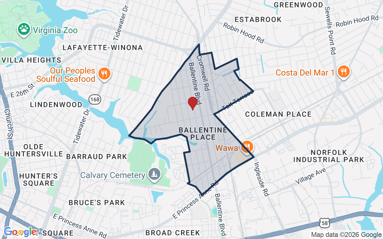
Explore this neighborhoodBallentine Place

Ballentine Place is an early-twentieth-century neighborhood in Norfolk, in ZIP codes 23509 and 23504. Ballentine Boulevard runs through its center.

$279KMedian sale · 12 mo
$199Sold $/sq ft
28dDays on market
10For sale now
$72KHH income
48.1%Owner-occupied

REIN MLS closed sales, trailing 12 mo · U.S. Census ACS 2024 5-year

Explore Ballentine Place →
Map of Ballentine Place with neighborhood boundaryNeighborhood

Norfolk houses for sale →

Value & historyComparables

Asking vs. assessment1% of $282,600City assessment record
Land share of assessed value46% · $131,100Improvements $151,500 · assessor record ✓
Price context: similar nearby homes$135,000 – $327,000The 6 most similar homes nearby (same city, within ~20% of this size, ~2.5 mi; 6 sold). Context for judging the asking price, not an appraisal or an estimate of this home's value.
3572 Kentucky AVE · 1.9 mi · 1,509 sqft$285,000 sold 2026-09
2845 Earlscourt AVE · 1.9 mi · 1,509 sqft$302,000 sold 2026-10
2733 Victoria AVE · 2 mi · 1,594 sqft$230,000 sold 2026-03

Own a home nearby? See what it is worth today: What's your Norfolk home worth?

Sale & Tax History

List Price

$2,450

Price / Sq Ft

$2

Annual Taxes

N/A

Monthly Tax

N/A

HOA

None

Tax Rate (effective)

N/A

Sale Timeline (this listing)

EventDatePriceDetail
ListedDec 10, 2025$2,450—
Off market—$2,450Last list price

Public-Records Assessment

Source: City Assessor via Hampton Roads Regional Parcels.

99% below assessment

Total Assessed

$282,600

Land

$131,100

Improvement

$151,500

Looking for multi-year tax assessments or prior sales? REIN MLS only ships data for the current listing. For full property history, check the city assessor record:

Norfolk Real Estate Assessor

Tax data above from REIN public-records sync. Sale timeline tracked from this listing's first appearance in our feed forward; prior owner sales are not included.

Comparable Properties

Comps are selected by city, bed count, square footage and price proximity. Composite similarity score weights bed match, sqft variance, price variance, and straight-line distance.

CompareThis home next to what else is for sale nearby

HomePriceBedsBathsSqft$ / sqft
3739 Tait Terthis home$2,450421,539$2
Loading nearby homes for sale…

Active comparables from the REIN MLS, the same homes shown under Comparable Properties. Context for judging the asking price, not an appraisal.

Questions buyers ask

Is 3739 Tait Ter in a good school zone?
The assigned zones on the listing record are Coleman Place Elementary (VaHome School Score 1.4/10), Norview Middle (VaHome School Score 1.2/10), BT Washington. School attendance zones can change — always confirm enrollment with the local school division.
Is 3739 Tait Ter in a flood zone?
FEMA maps this parcel in Zone X, outside the high-risk Special Flood Hazard Area. See the flood section on this page for details and sources.
Is there a gym near 3739 Tait Ter?
Yes — Joan kroc center is about 0.9 miles away, per the cached nearby-places record for this address.
Are there parks near 3739 Tait Ter?
Norfolk Parks & Urban Forestry is about 0.9 miles away.
Where is the nearest grocery store to 3739 Tait Ter?
Walmart Neighborhood Market is about 0.5 miles away. The closest dining on record is T's Seafood (0.4 mi).
Does 3739 Tait Ter have an HOA?
No — there are no HOA, condo, or association dues on the listing record for this property.
When was 3739 Tait Ter built?
It was built in 1950, per the listing record.

Answers generated from the listing record, verified school zones, FEMA data, and cached nearby-places data. Never invented.

Listed byMarlo Wynn

This is a rental listed by Marlo Wynn, BHHS RW Towne Property Mgmt. Showings, availability and application questions go directly to them.

Listing courtesy of Marlo Wynn · BHHS RW Towne Property Mgmt · REIN MLS #10598391