BarcoALL OTHERS AREA 20022ac Caratoke Hwy✓ Source: REIN MLS #10632949 · record updated May 12, 2026 · synced every 2 min · your inquiry is never resold
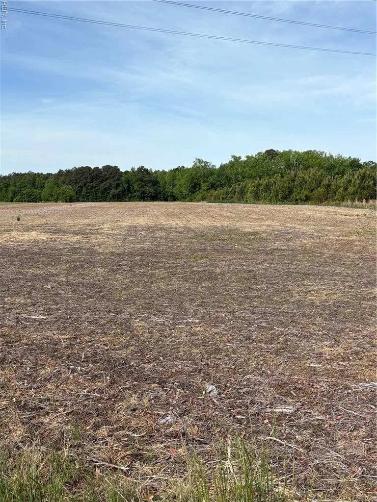
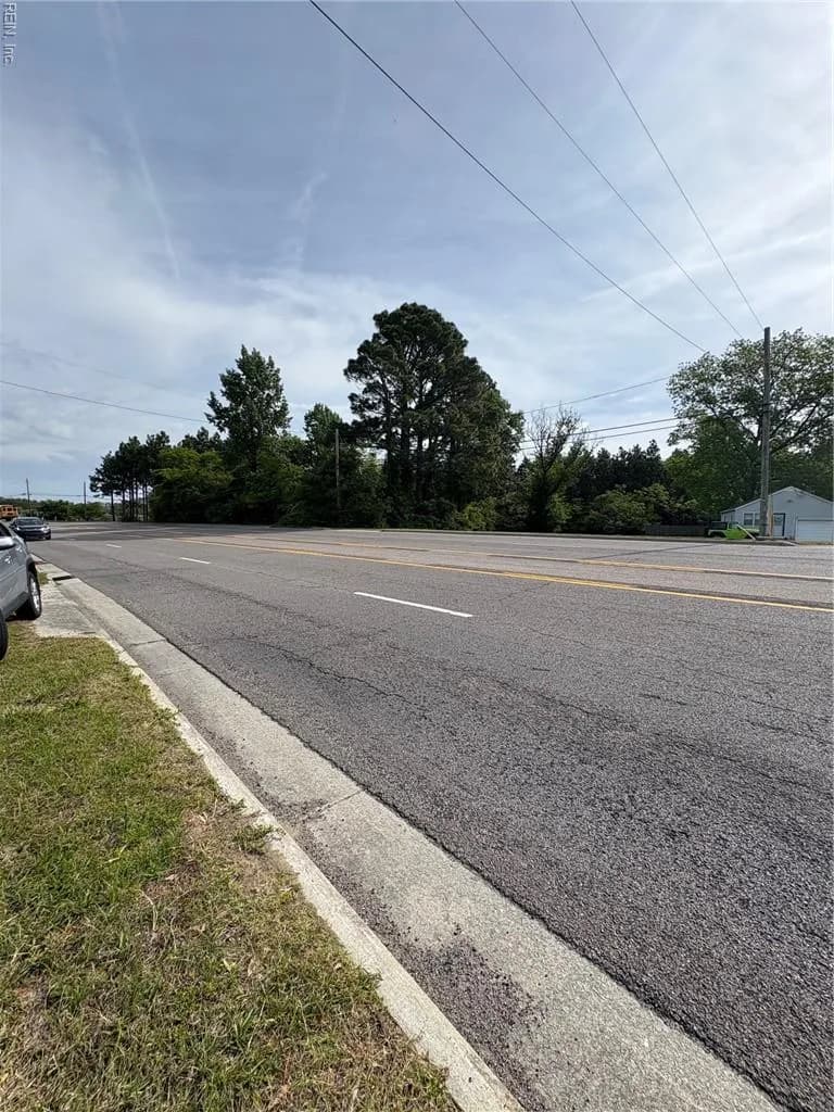
22AC Caratoke HWY, BARCO NC 27917 - Main photo
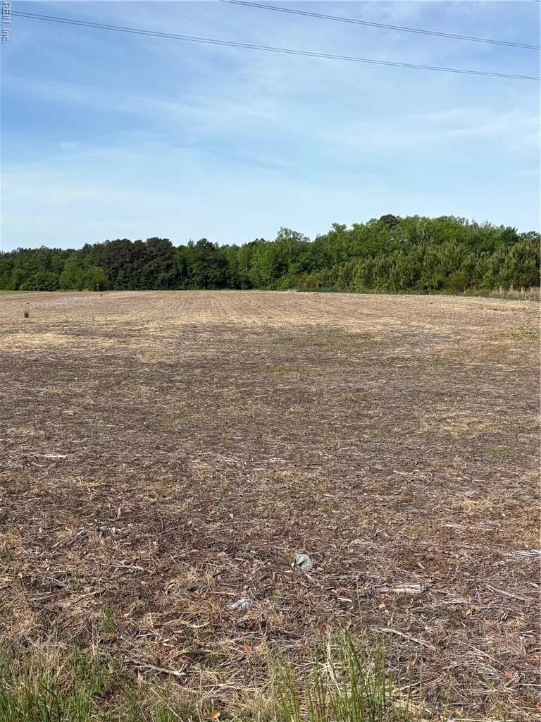
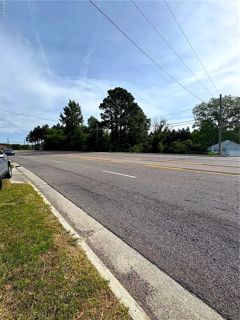
22AC Caratoke HWY, BARCO NC 27917 - Photo 2
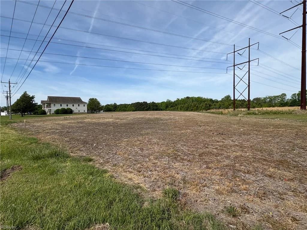
22AC Caratoke HWY, BARCO NC 27917 - Photo 3
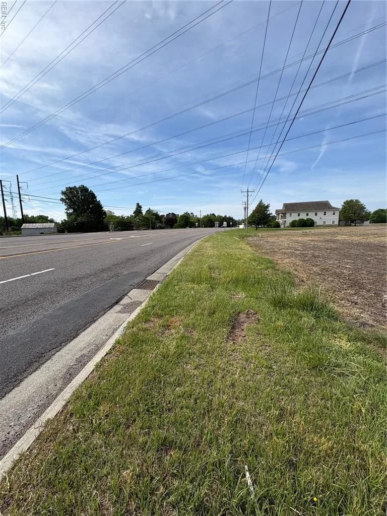
22AC Caratoke HWY, BARCO NC 27917 - Photo 4
22AC Caratoke HWY, BARCO NC 27917 - Photo 5
$327,000
8days on market

22ac Caratoke Hwy, Barco, NC 27917

ActiveLand and Farms · ALL OTHERS AREA 200

About this home

The listing, in the seller's words

Prime location off Caratoke Hwy. Zoned General Business. 30 miles to Chesapeake, 35 miles to OBX and 20 miles to Elizabeth City. Great visibility from both north & south bound traffic on 158.

Listing courtesy of Durene High · Long & Foster Real Estate Inc. · REIN MLS #10632949

VaHome team overview

Our read on this home

At a glance

Twenty-two-plus acres of raw land along Caratoke Highway in Barco, North Carolina — a rare stretch of Currituck County acreage sitting between the Outer Banks gateway corridor and the Virginia border, ready for your vision whether that means a private retreat, agricultural use, or long-range investment.

Read the full overview ↓

Why this home stands out

Large, contiguous acreage parcels along the Caratoke Highway corridor are genuinely hard to come by. At nearly 23 acres, 22AC Caratoke HWY gives you the kind of open canvas that most buyers in this region never get a shot at — room to build, farm, hunt, or simply hold a meaningful piece of northeastern North Carolina land with strong regional access and a coastal backdrop just minutes away.

ALL OTHERS AREA 200 and the Barco real estate market

Barco sits in the heart of Currituck County, North Carolina, a stretch of mainland that quietly connects the Hampton Roads metro to the Outer Banks. The Caratoke Highway corridor — the primary keyword for this area — is the main artery running south toward Corolla and the barrier islands, meaning this parcel benefits from steady regional traffic and genuine destination proximity without the density of the beach towns themselves. Currituck County has maintained a rural, unhurried character even as growth pressure from the Virginia Beach and Chesapeake markets has pushed southward. Barco itself is a small unincorporated community where neighbors tend to know each other and the pace of daily life reflects the land and water culture of the region. Farms, wildlife, and wide-open sky are the defining features here — not subdivisions or strip malls. For buyers who want acreage with elbow room and a coastal county address, this corridor delivers exactly that.

What's nearby

Day-to-day convenience along this stretch of Caratoke Highway is straightforward. Frog Island Seafood Inc is just half a mile away — a local seafood spot that reflects the working waterfront culture of Currituck County and makes a strong case for living this close to the source. A 7-Eleven is six-tenths of a mile out, handling quick stops for coffee and essentials without a long drive. For broader shopping, dining, and services, the Chesapeake and Virginia Beach corridors are accessible to the north, while the Outer Banks communities to the south expand your options considerably depending on the season.

For different buyers

For military families relocating

Dam Neck Annex is roughly 57 minutes north, making this Currituck County acreage a realistic option for service members who want serious land and distance from base-adjacent density. A private homestead, agricultural setup, or long-term land hold are all on the table — and Currituck County's lower cost of living relative to Virginia Beach makes the math work in your favor.

For buyers drawn to character

If your idea of the right property involves acreage, quiet, and a coastal county address rather than a neighborhood association and a postage-stamp yard, 22AC Caratoke HWY is worth your full attention. Nearly 23 acres of Currituck County land with highway frontage and Outer Banks proximity is a combination that rarely surfaces — and it rewards buyers who think in terms of years, not months.

More buyer questions

How far is 22AC Caratoke HWY from Dam Neck Annex?

Dam Neck Annex is approximately 57 minutes north via Caratoke Highway and the Virginia Beach corridor. The drive is straightforward with no major congestion outside of peak summer beach traffic.

What county is 22AC Caratoke HWY in?

The property is located in Currituck County, North Carolina — a rural coastal county known for its agricultural land, wildlife, and position as the mainland gateway to the Outer Banks.

Is 22AC Caratoke HWY in a flood zone?

Flood zone status for this parcel is detailed in the FloodRisk tile on this page — given the coastal county location, reviewing that information carefully before any development planning is recommended.

What are the permitted uses for land along Caratoke Highway in Currituck County?

Permitted uses depend on the current zoning classification assigned by Currituck County — agricultural, residential, and conservation designations are all common in this corridor, so confirming the specific zoning with the county planning office is an important early step.

How close is 22AC Caratoke HWY to the Outer Banks?

The Outer Banks communities, including Corolla, are accessible via Caratoke Highway heading south — typically a 30-to-45-minute drive depending on your destination and the season.

Curious about what nearly 23 acres in Currituck County could look like for your plans? Tom and Dariya Milan at LPT Realty are ready to walk you through it.

Summary generated by AI from public records and publicly available information.

Schools

  • ElementaryCentral Elementary
  • MiddleCurrituck County Middle
  • HighCurrituck County

Info provided by GreatSchools

Facts & features

The record, sourced

Type

Land and Farms

HOA

None

Taxes

$1,846/yr

County

Currituck County NC

Waterfront

Yes

MLS #

10632949

Construction & exterior

Waterfront
Not Waterfront

Lot, parking & ownership

Lot size
22.9500
Road surface
Paved
Subdivision
ALL OTHERS AREA 200
Zoning
GB
Ownership
Fee Simple
Possession
SETTLMNT
Disclosures
Deed Restrictions/Covenants

Sources: REIN MLS record · null fields are suppressed, never faked

Flood & environment

FEMA flood zone X · outside the high-risk area · FIRM 37053C

Flood Risk

Looking up FEMA flood zone…

Hurricane Evacuation Zone

Not in a designated hurricane evacuation zone.

Source: Virginia Dept. of Emergency Management — Know Your Zone

Location intelligence

Minutes to real places, not a score

Location & Neighborhood

Places within ~1 mile, ordered by distance from this property. Powered by Google Places.

Military Commute

Drive times to nearest bases

Drive times via Google Maps with current traffic patterns. Times are typical and may vary by time of day. Use the "Analyze" button up top to see live drive time to your saved base.

The numbers

Run the real carrying cost

Estimates only — taxes come from the public record; confirm rates with your lender. VA-eligible buyers: $0-down financing may apply.

Estimate your monthly payment

$1,946/mo

Principal & interest

$1,697

Property tax

$154

Home insurance

$95

PMI

None

HOA

None

Estimate only. Insurance assumed at 0.35% of home value annually. Actual taxes, insurance, and rate will vary by lender, credit, and property. Contact a lender for a personalized quote.

Value & history

Judge value on real ground

Why we show no algorithmic estimate.

National AVMs misprice homes whose value drivers they can't see. Instead: the sourced assessment above, the carrying cost, real price history, and honest comparables below.

Sale & Tax History

List Price

$327,000

Price / Sq Ft

$0

Annual Taxes

$1,846

Monthly Tax

$154

HOA

None

Tax Rate (effective)

0.56%

Sale Timeline (this listing)

EventDatePriceDetail
ListedMay 4, 2026$327,000
Currently listed$327,000

Looking for multi-year tax assessments or prior sales? REIN MLS only ships data for the current listing. For full property history, check the city assessor record:

Barco Assessor (Google)

Tax data above from REIN public-records sync. Sale timeline tracked from this listing's first appearance in our feed forward; prior owner sales are not included.

Comparable Properties

Comps are selected by city, bed count, square footage and price proximity. Composite similarity score weights bed match, sqft variance, price variance, and straight-line distance.

Market tempo

8 days on market — read it in context

Days on market reflects pricing, season, and inventory — compare it against similar nearby homes below before reading anything into it.

Questions buyers ask

Real questions, answered from the record

Is 22ac Caratoke Hwy in a good school zone?+
The assigned zones on the listing record are Central Elementary (GreatSchools 7/10), Currituck County Middle, Currituck County. School attendance zones can change — always confirm enrollment with the local school division.
Is 22ac Caratoke Hwy in a flood zone?+
FEMA maps this parcel in Zone X, outside the high-risk Special Flood Hazard Area. See the flood section on this page for details and sources.
Does 22ac Caratoke Hwy have an HOA?+
No — there are no HOA, condo, or association dues on the listing record for this property.

Answers generated from the listing record, verified school zones, FEMA data, and cached nearby-places data — never invented.

The people

You'll talk to a person, not a lead queue

TD

Tom & Dariya Milan

LPT Realty · Hampton Roads · answer their own phone

✓ Your inquiry goes to Tom & Dariya — never sold to strangers

Listing courtesy of Durene High · Long & Foster Real Estate Inc. · REIN MLS #10632949

Call or text (757) 777-7577

Ask Dariya — instant answers

Schools, flood, drive times, what it really costs to own — answered from this page's data, by chat or voice.

Schedule a private tour

Free, no obligation — your inquiry goes to Tom & Dariya, never resold.

22ac Caratoke Hwy, Barco — photo

See it in person — the record only says so much.

Call or text (757) 777-7577

22ac Caratoke Hwy, Barco, North Carolina 27917 · MLS #10632949 · Source: REIN MLS + public record. Information deemed reliable but not guaranteed — verify independently. School zones subject to change; confirm with the local school division. All locations are described by neutral geographic fact. Equal Housing Opportunity.